dimanche 29 mars 2015

Maroondah Dam Trail run 2015 - 52km

Aaaah, Maroondah Dam. My first trail run in Australia 5 years ago. An excellent memory, but an unfinished business as I had only run the 30 km course. So this year of course, I'm signed up for the 50km one, which will actually be 52km according to Brett's last info before we start. He had to change the course as the usual 10km at the start are off limit this year.

Arriving at Hendersons Picnic ground at the bottom of the dam in the dark early morning, to get the bibs (number 501) and meet with the same usual runners, the trails+ family: Cathy and Michelle, Mark, KathyMac, etc.

Soon after, the bus takes us out to near Dom Dom Saddle where we will start the race at 8am. The sun has been out for a little while but it is still freezing and humid at the start (it rained all night).


I'm wearing my jacket for the first 10km on an out and back trail with 2 brutal climbs. It starts nice enough on a wide forest track but then it gets really steep up, steep down, and steep up again. On that last climb we start seeing runners going down, a few guys, then Kellie the first girl chased by KathyMac soon after. At the top I find Ash volunteering at the tiny aid station and cheering everybody. And down I go again, I switch on my music and start flying down, thinking I might be killing my quads earlier than necessary, but they'll die anyway at some point, so might as well enjoy it while I can :-) I pass Mark, then Cathy and Michelle, still climbing. And then I pass Andy the sweep and I'm alone on the trail.


Back to the aid station at the start, and out again, this time for a 10km loop around Dom Dom Saddle. I'm all alone, and it's only going down, slightly, so you have to run really. I don't seem to be able to catch up to anyone though. We turn in a track with a big wild junkyard on the side... And then as I'm starting to climb again on the other side, I start hearing 2 girls laughing behind me, I first think Cathy and Michelle have caught up, but no, it's 2 other girls and a guy. We arrive at the aid station together where we meet Brett who probably just sent off the 30km runners (they started 2 hours after us from that same point, but were spared the out-and-back and loop). So now we are chasing them.

The trio stops at the toilets and I take a head start (haven't felt my stomach the whole race, that's a nice change!), thinking it might be useful when we start climbing. Plus I'm still freaking cold. And indeed they very soon catch up to me, pass me, and then jog just ahead of me. Well I'm glad for the guidance: we are going up a wide grassy fire break, not really a track. At the top we meet the actual track, and signs announce Mount Saint Leonard (the top of the course, after which it's all downhill) in 18.5km. Looks like we're not there yet! And then I lose them and run pretty much alone for hours, with either my music, or the songs of the birds and the wind in the eucalypts. This a just brilliant, we are in the middle of an awesome national park, I wouldn't want to be anywhere else.


The marking is almost non existant, except for turn offs that are very very well marked, hard to miss. It is based on the principle that you don't need any marking to go straight I guess, but then for scaredy-cats like me always afraid of being lost, there's not much to reassure you. Fortunately, I sometimes see other runners. Kelvin passes me, having run 6 foot Track just yesterday, and now running his 20th Maroondah Dam in a row! We chat for a while, he complains about his legs uphill, but he quickly leaves me in the dust afterwards :-)


At some point Mark arrives behind me just in time to call me back as I take the left side of a fork instead of the right. We run together for a while, make it to the top of a sort of a balcony with open views on the forest under us. The view is just... awesome, you can see the forest recovering from past bushfires in the area (the race has been moved from Feb to March to get away from bushfire season), and I feel privileged to be running here. We both stop for photos before heading out again.


Then I'm faster downhill and leave Mark behind, but he catches up uphill. We are now running on a wide track between giant eucalypts growing on both sides. Cockatoos and all sort of birds are singing, the wind moves the trees that creak eerily, you don't need an ipod here :-)
And suddenly on the side of that track, an aid station, two vollies with a small table. They offer to fill up my bladder, but as they tell me it's only 3km to the next one, I don't bother, I still have enough water, it's so cold I don't drink much anyway. Mark catches me again at that aid station and announces 10km to Mt St Leonard, and we head out again. Further down I get lost at an intersection and wait for him to show me the way, removing rocks from my shoes in the mean time. And then we keep going down and down and I lose him. I'm a bit stressed by the lack of marking, when I arrive at a picnic ground with tourists and lots of non-marked side tracks. Sometimes you have to pass the intersection to see the white arrow painted on the ground further down. Well, I find my way eventually, but no aid station where announced.


Actually the next aid station is around 37km at the bottom of MSL. And Mark has caught up again, so we head out together, climbing over some logs to get to the track, sign announcing the summit in 1.2km. And somehow I paused my GPS... We climb together, it feels much easier than 5 years ago. We even catch up a girl from the 30km. Mark tells me how he now has a tradition of making a detour to climb the radio tower at the top to get the view before heading down, and I decide to join him. Not like I'm running for a podium or anything ^^. And it might be my one and only chance to climb that tower ever. So here we make it to the top where military are training, surprised as we go the wrong way, trying to point us back on course. We also have to tell the other girl not to follow us. And here we climb to the top of the radio tower, and the view is well worth it!

Then he sends me off downhill, telling each other to take care. I suddenly understand what they meant by dangerous downhill. First, it's steep, really steep, but that alone wouldn't be a problem. But then it's also covered in branches, twigs, barn, a deep thick mat of them, you don't touch the ground, you have to be super extra careful to not roll on it. I slow down and take extra caution, and fortunately it's not long until I touch ground again. Between overgrown vegetation. And then steep down again, I pass the girl from before, and start making good speed, with music again, down down down, it's only downhill now and I get excited, music again, queen-of-the-world mode. All the more when I start passing more late 30km runners. And a group of 50km runners who skipped the loop because they were too slow. Then it starts going uphill again, offering me a rest from the stomping downhill.

And then a wide sandy track goes downhill at a perfect slope and I take some speed again, pass a the 50km trio from before, and a 30km guy in pain, at full speed. And start suffering from stitches that force me to slow down. More uphill as a welcome rest, and the trio pass me again. I keep up with them and even pass them again downhill, and arrive before them at the last aid station 4km from the finish. But they don't even stop and pass me while I'm drinking some electrolytes (it's finally warming up now). And then I never catch up again, there is too much uphill for what I expected to be a long downhill to the finish, so I decide to just take my time walking and enjoying, don't feel like forcing myself to run up any more. We are getting close, I recognise the area, and then an intersection with no marking, except an arrow coming from the left and turning where I come from... I assume I should follow it in reverse, in the absence of any other marker, and a hiking sign points that way for the lookout anyway. So here I climb to the lookout, stop for a few photos, ask my way to a group of tourists who don't seem to understand a word of what I'm saying but point me down anyway. No marking at all, I'm probably off course, but all trails should lead back to the dam at some point, shouldn't they? I got sort of used to the lack of marking so I'm not as stressed about it anymore.

So I enjoy the view, make my way down to the dam, take more photos,

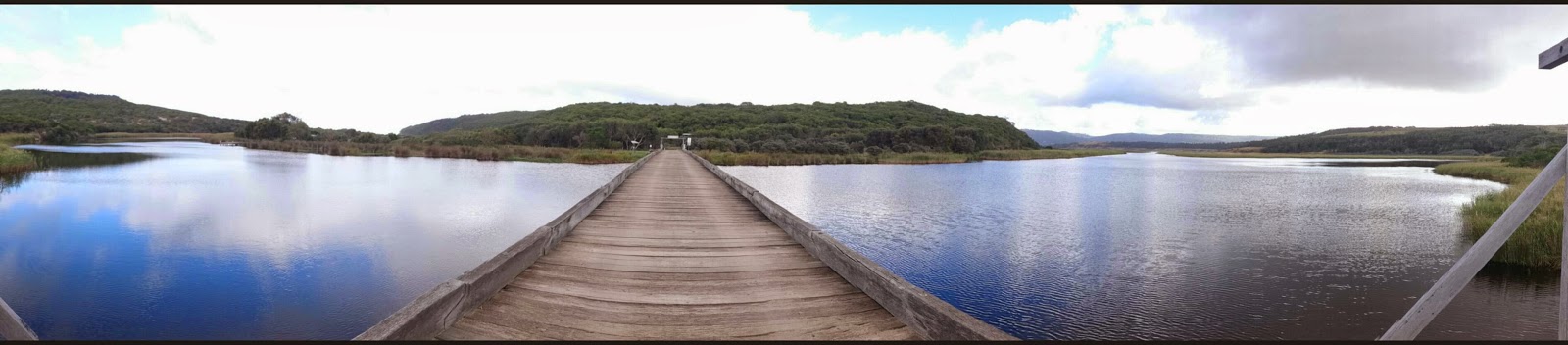
cross the dam, and there I finally find a marker again. Then it's only down the stairs to the picnic ground, across the carpark, and to the final stretch between fences to the finish line! Where Brett welcomes me.

I'm done well under 7h :-D Mark follows only about a minute later.

Kellie won the female race in 4h41, KathyMac finished 2nd in 4h59 after a final mad dash for sub 5.
Cathy and Michelle got lost, chatting all the way, and arrive 1h later.


Then Andy with all the markers and the last 50km runner.

After that I was unable to walk properly for a few days. My quads were completely smashed! But I had fun the whole way, so that was worth it :-) Took Monday off as a rest day and massage before returning to my beach run on Tuesday. I have less than a week to recover before Rollercoaster.

Some links:


samedi 28 mars 2015

Dendy Park Trail run 2015


After the giant thunderstorm that hit Melbourne yesterday night, just on cue to welcome us back home from the Grampians and Great Ocean Road holidays, this morning is much calmer. The damage can be seen with some trees and branches fallen, and a few puddles, but we are lucky with perfect weather, if a bit cool at the start. We reach Dendy Park early, still in the dark, to get our bibs and chat with everybody before the 7am start.

Brett leads us a few hundred meters away from the line to start, to make it exactly 50km after the 27 loops of 1.8+km. We already have to run to make it in time to the start :-) And here we go! The first few loops are nice and cool, only problem is the portaloos being late, you have to go "off course" for toilets. My goal is to run the 50km in 5h or just under and finish fresh, as a training run for my upcoming 24h race in Portet-sur-Garonne.

The loop is nice and flat, a tiny uphill shortly after the start to get to the road, run along it briefly on concrete, then back on the sandy track, a crossing of the access lane to the carpark, with a volunteer on service the whole time, downhill around the BBQ area, and back to the start around the grassy area.

After an hour, the marathon starts and more people join us. At 9am it's the half-marathon starting, with a bunch of people in white T-shirts running for stem cell research. Apparently they're all from the same family, and other family members are running half-marathons on the 5 continents this same day, in a giant virtual relay for one of their (sick) cousins.

As the day progresses, there are more and more people in the park, walking their dogs, or their kids, or jogging. After about 12 laps, I'm getting a bit sick of it. I guess I'm paying for my "holiday" week and the 80km of running I already have in my legs. Plus I'm losing count of my laps, but that's when Robyn encourages me with a "15laps left!", somehow I thought I had more left than that, so the good surprise boosts me again!

And then Falk arrives from his house down the street, just in time! We run 5 laps together at a good pace, having good company will always cheer you up immediately. We see the 10km runners starting at 10am. There are now runners from 4 different races on the course, running at all different speeds. Not for long though, as Magnuss finishes the 50km in 3h18 (sic) after consistently overtaking me all morning.


And then Peter overtakes us around 10.30 on his way to smash his marathon in 2h38, always looking so easy.


I stop at the aid station every lap to drink some energy drink, and sometimes eat a lolly, in an attempt not to upset my stomach with anything bigger. KathyMac is volunteering and cheering at every lap. By the way, thank you all the vollies!


And then Falk is done with his 12km and leaves, and I take advantage to be alone again to take a pit stop. But then on the next lap as I have just passed Cathy chatting happily with Michelle and another girl Jo, I chat with them for a while but I'm running a bit faster, aiming to run it under 5h. I meet Falk again coming in reverse to see Cathy. I now have only 10 laps to go.


The 10km runners are done, then at 11am the 5km run starts. I'm feeling better now that there's not long to go, and the sun is out. It's actually pretty warm now. I pass a woman who encourages me with a comment like "I can honestly tell you that you look better than some of the 5km runners". That's about the distance I have left now, can't wait to be done, I'm counting the last laps. All the more when every time you pass the line, someone running along you might be done with their own race and stops, while you go out for yet another lap.


Tom is managing the timing, and tells me every time how many laps I have left. Not many now. I can already see that I will be just a little bit short for under 5h, but I really don't feel like pushing any harder to gain a few minutes. At 12am the final race starts, 2km for kids. I'm on my last lap, glad to tell the traffic marshall that he won't see me again. Sue and Mark are just ahead with another guy from the 50km, finishing their marathon a few seconds before me. Done in 5h03, feels good to stop!


Plus I'm welcomed by Brett announcing me second female in the 50km. And just in time to then see Tom smashing his own PB to win the 2km in under 8'! Before the proud eyes of his father :-)

The presentations follow, with the 50km female being last, waiting for the three chatty girls to finish hand in hand, leaving Brett with one trophy for three third place :-)


So I get a nice souvenir trophy for 2nd place and a pair of socks, just a few minutes after Kim finishing in 4h56. I haven't seen her the whole race, we were pretty much doing the same pace the whole time.


Yet another fun day at a trails+ race, great ambiance, great crew, and the best race director :-D

We end up in Falk's swimming pool for a nice cryotherapy.

And the next morning I was running on the beach again :-) Addictive, they say? ;-)

Results
Race website
GPX

mardi 24 mars 2015

Great Ocean Road


Warrnanbool foreshore trail
Après la longue route depuis les Grampians, on se pose vers Warrnanbool pour la nuit. Le lendemain matin je pars courir sur le foreshore trail, le long de la côte, avec des vues sensationnelles sur cette côte très découpée.
Une quinzaine de kilomètres plus loin, et au moins 2 ou 3h plus tard en comptant toutes les pauses photos :-) je retrouve Bernie à Thunder Point, qui me prend en stop vers Tower Hill Reserve.


Tower Hill reserve (volcano)
Il s'agit d'un ancien volcan dans lequel il y a maintenant un grand lac (ou plusieurs petits lacs selon l'état de sécheresse) et une réserve naturelle, la plus ancienne de l'état du Victoria. Pour se mettre en jambes avant de manger, on enchaîne les 4 balades suggérées sur la carte : montée au sommet, tour d'un petit cratère, boardwalk autour d'un étang avec cachette pour observer les oiseaux...

Puis picnic au milieu des émeus qui ont une manière assez insistante, pour ne pas dire agressive, de vouloir partager notre déjeûner. Les panneaux demandant de ne pas nourrir les oiseaux devraient plutôt prévenir de ne pas laisser les oiseaux se nourrir tous seuls...
Une fois repus, on part pour le grand tour du cratère, sur des sentiers un peu moins fréquentés, où on fait du coup une rencontre intéressante : un copperhead snake en plein repas.
On essaye de monter jusqu'à un point de vue mentionné sur la carte, mais le sentier semble être désaffecté. On y croise tout un troupeau de kangourous sur la pente au-dessus de nous, avant de faire demi-tour. Les jambes commencent à fatiguer, 13km de footing + 20km de balade et il est même pas 16h.

Great Ocean Road the tourist way
Retour à la voiture pour parcourir The Great Ocean Road, façon touriste. C'est une célèbre route sinueuse, le long de la côte entre Warrnanbool et les fameux Twelve Apostles, une côte magnifique et très découpée, avec des points de vue à tous les coins, et des dizaines de cars de touristes partout. Le principe : rouler quelques kilomètres, s'arrêter sur un parking avec des dizaines d'autres touristes, marcher un maximum d'1km (retour compris) pour aller au point de vue, se prendre en photo avec l'attraction, et repartir. Repeat. Repeat. Repeat.
First stop Bay of Islands.


 Second stop, la grotte.

Troisième stop, the London Bridge, qui s'est partiellement effondré vers 2005, alors que des touristes étaient de l'autre côté, ils ont dû aller les évacuer :-)

Quatrième stop the Razorback, un super rocher effilé à la crête taillée comme de la dentelle. Marcher 1km à chaque fois au milieu de tous ces touristes, c'est plus épuisant que de courir 20 bornes...!

Cinquième stop les fameux Twelve Apostles. Là on entre dans une autre ligue. Le parking doit bien pouvoir caser quelques milliers de voitures. Du coup on prend le chemin non touristiques vers les Gibson steps, 2km de chemin en bord de route, un autre parking (si j'avais su...) pour atteindre un escalier taillé à flanc de falaise pour descendre sur la plage, avec une vue originale sur les 12 apostles.

Bon, on se fait quand même le boardwalk traditionnel au milieu d'une foule hallucinante, vite fait.

Manque de bol le coucher de soleil se fait derrière les nuages, raté pour les jolies lumières. Par contre on repère un antechinus !

Great Ocean Walk - Castle Cove, Aire River, Cape Otway Lighthouse
Puis direction Castle Cove pour passer la nuit au bord du Great Ocean Walk, la version pour randonneur. Le lendemain matin je pars en courant pour une section et demie de ce sentier de rando qui abrite aussi un superbe ultra-trail en octobre : GOW100. Je m'arrête toutes les 30 secondes pour faire des photos de la mer tant que le sentier est en haut des falaises, puis il commence à serpenter entre la végétation et j'avance plus vite jusqu'au terrain de bivouac d'Aire River, où d'un coup 3 gars sont assis au milieu du chemin, à regarder... un koala ! Je reste profiter du spectacle pendant 10mn, on a droit à une série d'acrobaties alors que le koala passe d'arbre en arbre, en sautant.

Puis je repars pour traverser Aire River sur un pont de bois


avant de remonter de l'autre côté, une longue côte dans le sable mou jusqu'à un point de vue sur la mer en contrebas.

Puis retour sur les falaises

et direction Cape Otway et son phare, fin de la sortie.

Surf Coast
Picnic à la plage de Blanket Bay un peu à l'écart des touristes et on repart vers Anglesea, dernière étape sur la route vers Melbourne, via un autre phare sur le trajet du Surf Coast Century, un autre ultra-trail de bord de mer.
vue depuis Aireys inlet lighthouse 
camping d'Anglesea
Le lendemain c'est journée de repos pour préparer ma course de dimanche : Dendy Park, et ça tombe bien il pleut... Après le spa et la piscine du camping d'Anglesea, on s'arrête à Jirrahlinga, un sanctuaire qui abrite koalas, kangourous et autres animaux locaux.


Total
Puis direction le ferry pour rentrer au plus court et avoir une bonne nuit de sommeil avant de courir à 8h demain. Bon, en guise de semaine de repos, j'ai déjà 130km dans les jambes avant le départ, mais seulement une petite moitié en courant, le reste en rando.